Business
We offer the fastest solution for
aircraft defense using drones.
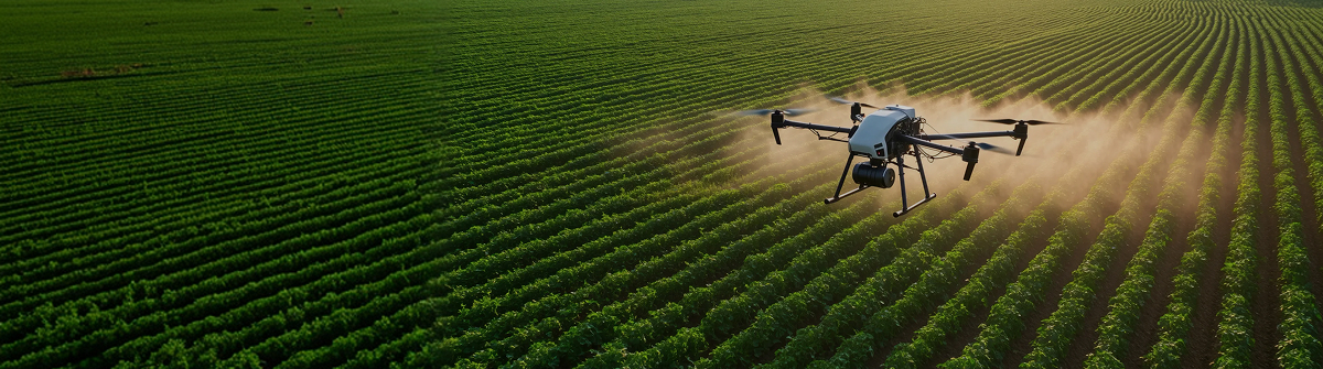
Aerial Application/Drone Aerial Surveying
![]() AERIAL PEST CONTROL
AERIAL PEST CONTROL
Smart farming starts
with drone aerial application
We deliver precise, efficient crop protection using advanced drone technology.
Manage large fields quickly and safely from the air.
Why drone aerial application
-

Faster operations
Drones move quickly across crops and forested areas to complete application work, saving significant time compared with manual labor or ground equipment.
-

Lower labor costs
Automated flight systems reduce how many people you need on the field, which lowers labor costs over the long run.
-

Even spray coverage
RTK positioning, GPS, and onboard sensors let drones apply product exactly where it is needed.
-

Less limited by terrain
Drones reach hills, uneven ground, mountains, and wooded areas with ease, so you get consistent coverage across the whole site.
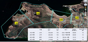
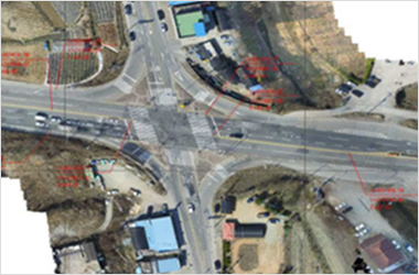
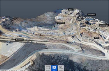
Drone Surveying
3D map process

Intake
Consultation based on location, area, and objectives
Select targets for imaging
Flight plan
Flight approval and scheduling
(about 1–2 weeks)
Set capture plan (2D / 3D)
and test flights
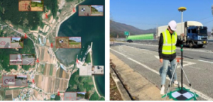
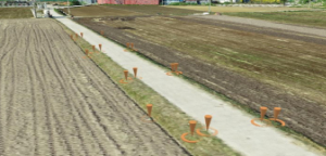
Ground control points (GCPs)
Choose GCP locations
Install aerial targets and
survey ground control
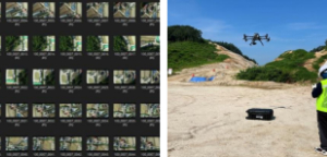
Drone aerial capture
Set overlap for data quality
On-site live checks to
verify image quality
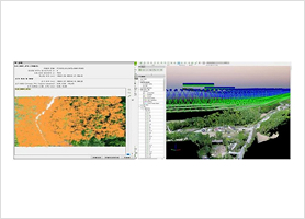
Data processing
Using DJI Terra, Pix4D,
and similar tools
Mapping, correction,
and orthomosaic analysis
Deliverables
Point cloud, DSM, and 3D model outputs
Build a diagnostic database
3D digital
terrain model services
step. 01
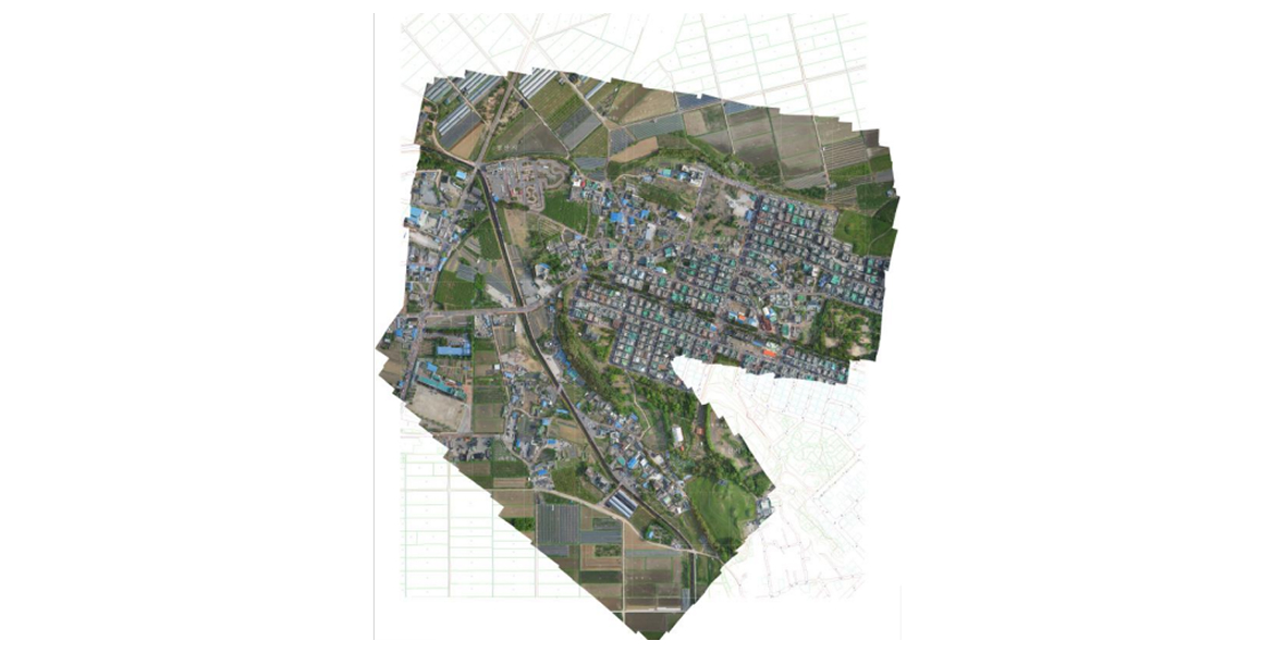
UAV photogrammetry orthomosaic production
step. 02
Update existing digital terrain models using orthomosaics
step. 03
Overlay new orthomosaics with existing terrain data
step. 04
Compare and validate against prior terrain models
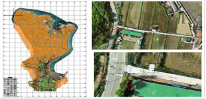
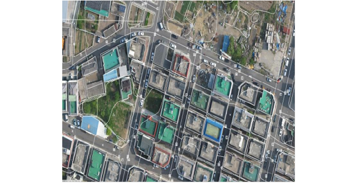
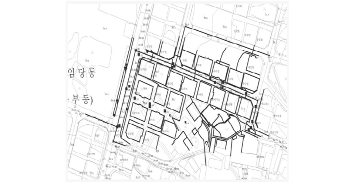
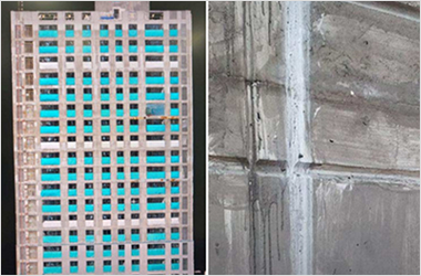
3D map — applications
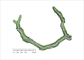
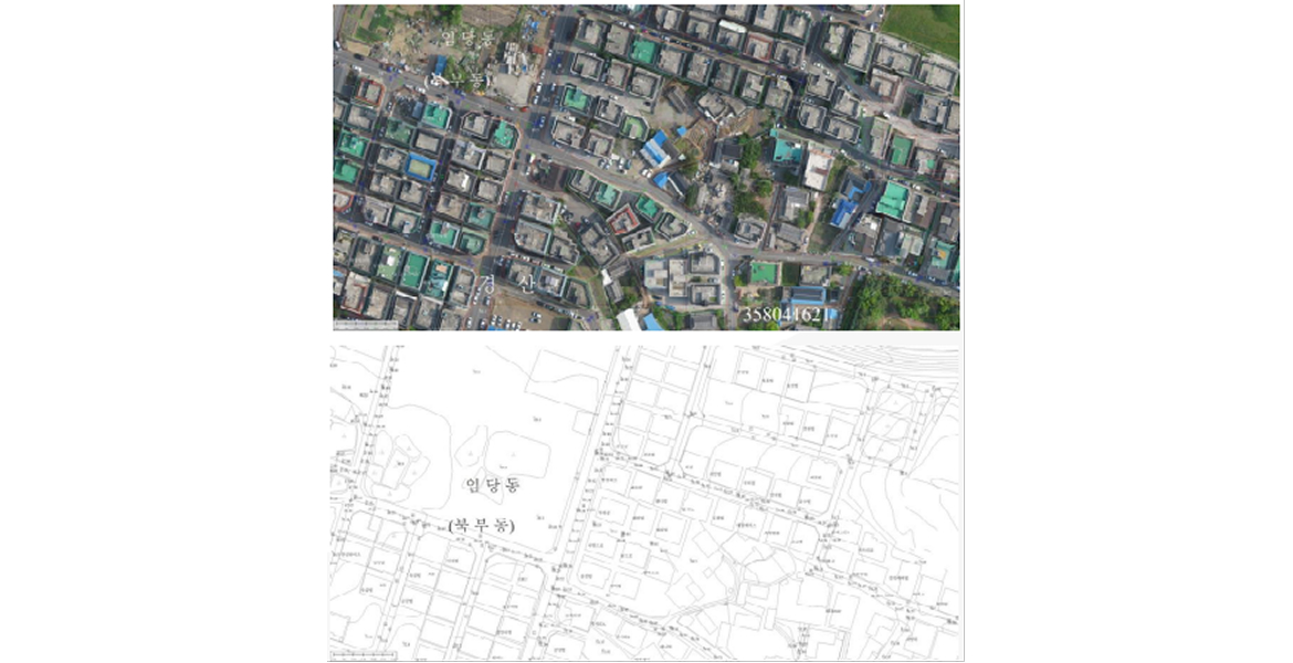
Orthophoto
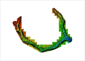
Digital Surface Model (DSM)
Contour Map
Feature Detection and Image Matching
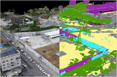
Digital Twin
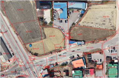
Geographic Information System (GIS)
Basic Design and Detailed Design
Construction Management and Schedule Management
Structural Safety Assessment Using 3D Modeling
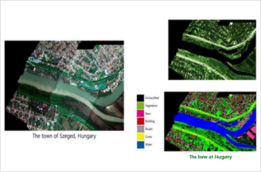
Environmental Flood Disaster Prevention